BIMA, “THE GOOGLE MAPS OF THE SEA” WAS BORN IN GALICIA

23.03.2022
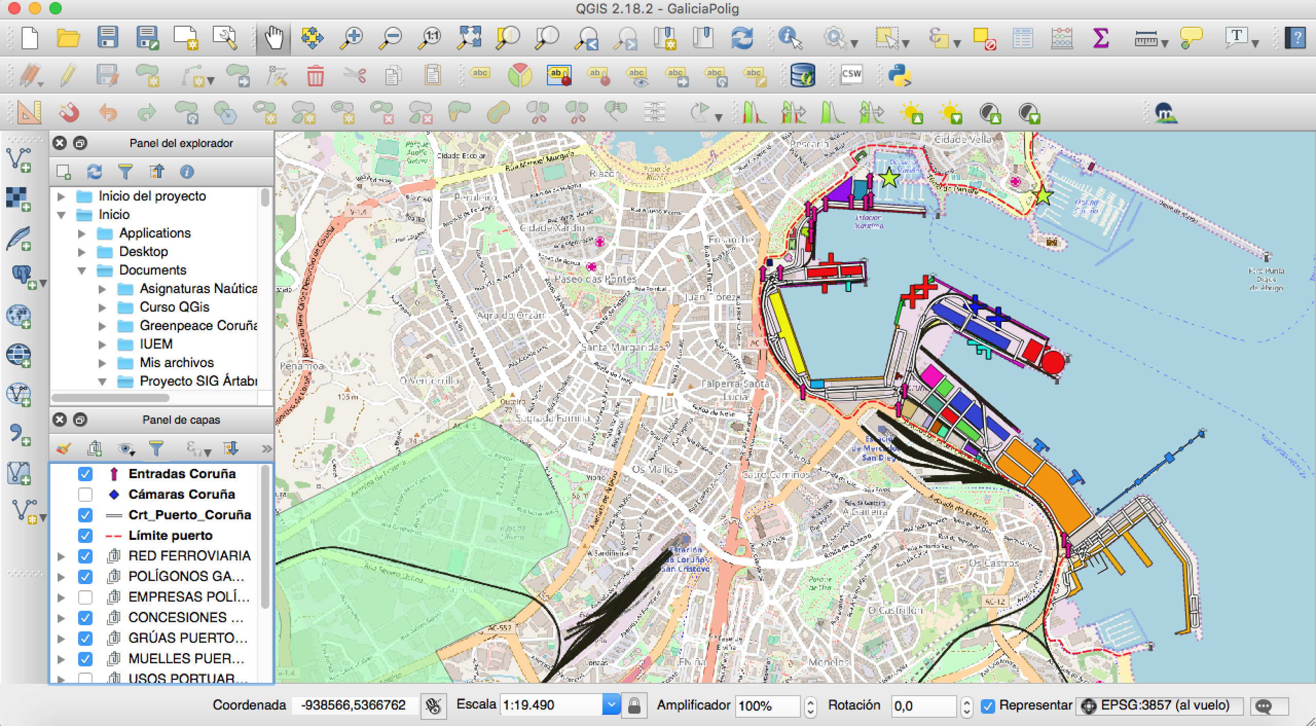
BIMA converts data related to the marine environment into cartographic information, such as a digital cadastre of the sea
This pioneering Sherpa Journeys project has military, fishing, energy or heritage uses, among others
Through a series of filters it allows, in a single panel and visually, to locate the ideal space in the sea to place a wind farm, military maneuvers or optimize capture management

The Galician BIMA project, which is currently being accelerated in the Sherpa Journeys program for entrepreneurs of Sherpa do Mar, consists of crossing databases related to the marine sector and converting them into cartographic information thanks to to Geographic Information Systems (GIS). In short, it is an innovative digital cadastre of the sea.
Through various filters, this new tool allows to draw a marine map for a specific use. "We are collectors of information, especially public information, the Google Maps of the sea," summarizes Iván García (A Coruña, 1993), a nautical engineer. Together with the marine biologist Hugo Regalado (Badajoz, 1995) they are the creators of this start-up that offers personalized technological solutions and facilitates analysis and decision-making.
BIMA was born from the "need to digitize and exploit information in an effective way helping environmental, social and economic sustainability" and is focused on fishing, port operations, maritime transport or energy.
Heritage management or mapping of military zones are other uses that yield new data. “We have hit a moment in which better management is beginning to be proposed” of the marine territory, and this ranges from waste to geographical limits. A perspective that has given them more than one surprise: “There are interesting things, such as historical-military residues, you can even see World War II bombs; there is a lot of unknown heritage”, they conclude.
This pioneering program, which condenses a huge amount of data in a single panel, is a "central data" that allows everything from finding the best position to locate a wind farm or a raft to drawing a historical pattern of fishing routes (a tool for catch optimization and fuel saving). "We put some conditions and you filter until you reach the ideal area, and everything visually," they explain.
New markets thanks to Sherpa do Mar
BIMA is part of the Sherpa Journeys accompaniment program, an experience that "helps us to lay the foundations of the project a little more and to open up a perspective of new markets that we can enter", such as the north of Portugal.
About Sherpa do Mar
Sherpa do Mar is a project integrated into the INTERREG VA Spain-Portugal Cross-Border Cooperation Program (POCTEP) 2014-2020, co-financed 75% by ERDF funds, whose purpose is to launch a cross-border entrepreneurship network in the marine-maritime field and blue economy, through the Sherpa Journeys program, which favors the generation of employment and the increase in business competitiveness through the promotion of technology-based companies.
The project is led by the University of Vigo, through the REDE research group, Campus do Mar and the R&D Office, and the Vigo Free Zone Consortium, the Galician Innovation Agency (GAIN) and the universities of Santiago de Compostela and A Coruña. On behalf of Portugal, the Asprela Technology Transfer Association (UPTEC), the U. Porto-Innovação of the University of Porto (UPIN), the Interdisciplinary Center for Marine and Environmental Research (CIIMAR) and the Fórum Oceano-Association of Sea Economy.